From Flight to Deliverables — Precise Aerial Data Your Team Can Actually Use

Aerial imaging and drone data services for councils, infrastructure, environmental and industrial teams — from site mapping to asset inspection and beyond. We combine CASA-licensed drone operations with precision photogrammetric processing to deliver orthomosaics, digital elevation models, 3D point clouds and high-resolution imagery you can hand straight to engineers, planners and stakeholders.

Whether you need a single site captured this week or ongoing progress monitoring across a multi-year project, our Melbourne-based team plans the flight, manages the airspace approvals, and delivers as much or as little as you need — raw capture data handed straight to your own team, or fully processed outputs ready for your GIS, CAD and reporting workflows.

High-Precision Mapping

Professional-grade accuracy using ground control points and calibrated processing workflows.

📍

Australia-wide Coverage

Serving clients throughout Australia from our South East Melbourne base.

🛡️

CASA Licensed Operators

RePL and ReOC accredited pilots. Fully insured with professional indemnity coverage.

Our Services

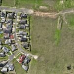
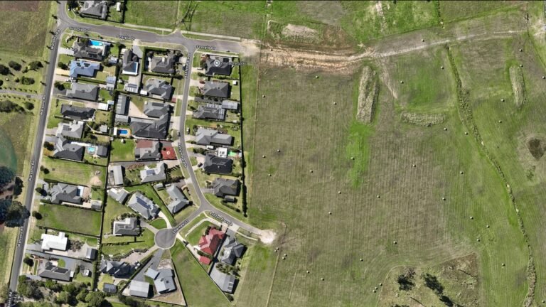
Residential subdivision orthomosaic mapping from aerial drone imagery

Orthomosaic Mapping for Construction

Discover how orthomosaic mapping enhances construction site management, progress tracking, and as-built documentation. Learn about drone-based aerial imaging for construction projects.

Learn more →
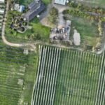
Aerial orthomosaic mapping of vineyard and orchard in Australia

Aerial Imaging for Agriculture & Orchards

Professional aerial imaging and drone mapping services for Australian agriculture. Explore orthomosaic maps and elevation data for orchards, vineyards, and broadacre farms across South East Melbourne and beyond.

Learn more →
Stylised aerial view with camera focus frame and drone, representing professional aerial photography and videography

Aerial Photography & Videography Services

Professional aerial photography and videography services across Australia. Stunning drone imagery and cinematic video content for construction, real estate, marketing, and commercial projects.

Learn more →
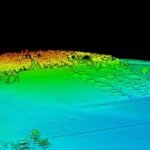
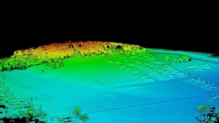
Digital elevation model showing hilly terrain with elevation data visualisation

Digital Elevation Models for Earthworks & Construction

Expert digital elevation model services for earthworks and construction projects. Accurate drone-derived DEMs for cut and fill calculations, volume measurement, and site planning across South East Melbourne.

Learn more →

GIS & Spatial Analytics Services

Professional GIS and spatial analytics services across Australia. Transform aerial imaging data into actionable spatial intelligence for construction, agriculture, environment, and infrastructure projects.

Learn more →
Aerial orthomosaic mapping of vineyard and orchard in Australia

Site Documentation & Aerial Records

Independent aerial data capture for property, construction and site documentation. CASA-certified drone data, delivered as a structured Site Record Pack. Melbourne-based, Australia-wide.

Learn more →
Our Work

Industries We Serve

Construction & Development

Site progress monitoring, progress documentation, and volumetric analysis for development projects.

Agriculture & Viticulture

Crop monitoring, vineyard assessment, yield analysis, and precision agriculture insights.

Mining & Resources

Aerial site mapping, stockpile volumetrics, pit monitoring, and asset management.

Environmental & Conservation

Habitat mapping, vegetation monitoring, environmental assessment, and conservation planning.

Real Estate & Property

Property marketing imagery, site analysis, development potential assessment, and portfolio documentation.

Infrastructure & Utilities

Pipeline and transmission corridor monitoring, asset inspection, and maintenance planning.

Local Government

Urban planning, land management, asset mapping, and community engagement imagery.

Surveying & Engineering

Capture data that supports licensed surveyors and engineers — topographic mapping inputs, structural monitoring, and engineering documentation.

About Aerial Imaging Australia

CASA-licensed aerial data capture based in South East Melbourne, serving clients across Australia.

Frequently Asked Questions

What areas do you service?

We are based in South East Melbourne, Victoria, and we provide professional aerial imaging and spatial data services throughout Australia. Whether you're located in a capital city or regional area, our team can deploy to your location to capture the data you need.

What level of detail can I expect from drone data?

The detail and precision of drone data varies based on several factors: your project requirements, flight altitude, camera specifications, and whether ground control points are used. We work closely with you to understand what level of accuracy you need, then determine the best approach to achieve it. From high-resolution imagery for visual documentation through to precision data capture for engineering and construction, we have the tools and expertise to deliver the right solution.

Do I need CASA approval for drone work on my site?

We handle all regulatory requirements and CASA compliance. Our operators are fully certified, and we manage all approvals and permissions needed for your project. You can focus on your business while we take care of the technical and regulatory side.

What deliverables will I receive?

Deliverables depend on the service type. For aerial photography, you'll receive processed, colour-corrected images. Orthomosaic projects deliver georeferenced composite maps. 3D modelling services include point clouds and surface models. GIS projects include spatial data layers ready for integration with your systems. We discuss your specific needs during project scoping.

How long does a project typically take?

Every project is different. Timelines depend on site size, complexity, weather conditions, and the type of deliverables you need. We'll give you a realistic timeframe once we understand your requirements — and we'll keep you updated throughout the process.

What's the difference between a DEM and an orthomosaic?

A DEM (Digital Elevation Model) is a 3D representation of terrain and surface features, showing height information at each point. An orthomosaic is a 2D overhead map created by stitching aerial images together with consistent scale and positioning, like a very detailed aerial photograph. A DEM is ideal for volumetrics and topographic analysis; an orthomosaic is better for detailed visual documentation and measurement. Learn more in our Insights article on DEMs vs orthomosaics.

Get in Touch

Contact Information

Address

Hampton Park
Victoria 3976
Australia

Send us a Message

Homepage Contact Form