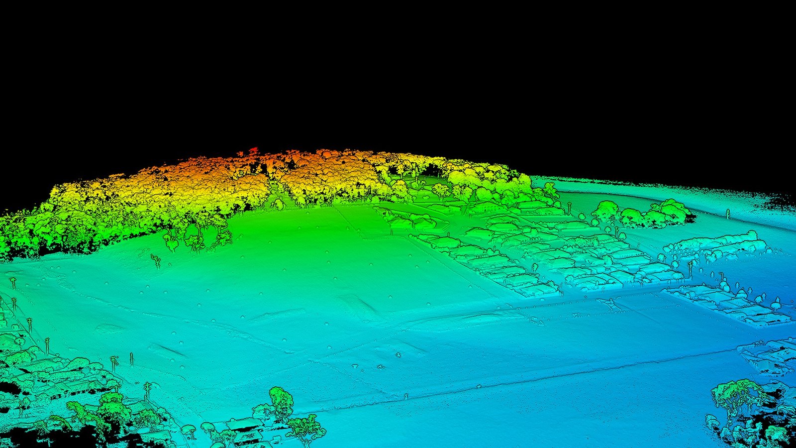
Digital Elevation Models

High-precision elevation data for engineering, planning, and analysis

Hilly terrain DEM project

Hilly Terrain DEM

Digital Elevation Model of a complex hillside property with significant elevation variation. Captured using drone photogrammetry with ground control points for precision surveying.

Type: Digital Elevation Model

Terrain: Hilly with significant relief

Application: Engineering design and slope analysis

Agricultural land DEM project

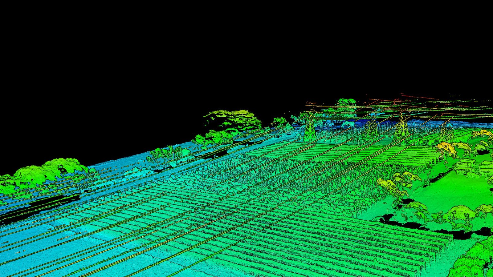
Agricultural Land DEM

Elevation model of agricultural property with gentle terrain variation. Suitable for drainage assessment, irrigation planning, and land management analysis.

Type: Digital Elevation Model

Terrain: Gentle undulating farmland

Application: Drainage analysis and farm planning

DEM Applications

📐

Civil Engineering

Infrastructure design, cut-and-fill calculations, and site planning based on accurate ground elevation.

💧

Drainage & Hydrology

Analyse water flow, model flood risk, and plan stormwater management systems with precision elevation data.

⛏️

Mining & Quarrying

Volume calculations, pit design, and progress monitoring for extraction operations and reclamation.

🌍

Environmental Management

Assess terrain conditions, monitor erosion, and support environmental planning and restoration work.

🏗️

Construction

Site characterisation, earthwork planning, and progress monitoring for construction projects.

📊

Urban Planning

Comprehensive terrain understanding for development planning and infrastructure assessment.

Need elevation data for your project?

Our team can deliver high-precision DEMs tailored to your specific requirements. From small-scale assessments to large multi-site programmes, we've got you covered.

Request a Quote