What Are Digital Elevation Models?
A digital elevation model (DEM) is a three-dimensional representation of terrain elevation across a geographic area. For earthworks and construction projects, DEMs provide accurate height data that's essential for planning, design, and execution. Unlike traditional surveying methods, drone-derived DEMs can be generated quickly and cost-effectively, offering comprehensive coverage of large project areas.
Modern DEM technology has transformed how construction teams approach earthworks. Whether you're planning land grading, road construction, dam building, or site preparation, accurate elevation data is fundamental to successful project delivery.
Why Earthworks Projects Need Digital Elevation Models
Earthworks represent one of the most significant cost components in construction projects. Any errors in cut and fill calculations, volume measurements, or grade planning can lead to expensive delays and budget overruns. Digital elevation models eliminate guesswork by providing precise, geospatially referenced height data across your entire project site.
With accurate elevation data, your team can:
- Calculate cut and fill volumes with confidence
- Plan optimal grading strategies before work begins
- Verify contractor work against design specifications
- Track progress and identify variations early
- Manage material balance and waste streams
- Identify potential site risks and constraints
Types of Elevation Data: DEM vs DSM vs DTM
When discussing elevation models, you'll encounter three related acronyms: DEM, DSM, and DTM. Each captures different aspects of the terrain:
Digital Surface Model (DSM) includes all surface features—buildings, vegetation, and structures. Digital Terrain Model (DTM) represents the bare earth beneath these features. Digital Elevation Model (DEM) is a broader term encompassing both approaches, depending on project requirements.
For most earthworks projects, you'll want a DTM that represents bare earth elevations, enabling accurate cut and fill calculations. Learn more about the technical differences between DEM, DSM, and DTM models on our blog.
Benefits of Drone-Derived DEMs for Earthworks
Accurate Cut and Fill Calculations
Cut and fill volumes are the foundation of earthworks planning. DEM data generated from drone surveys provides the precise elevation information needed to calculate these volumes accurately. This enables better budget forecasting and helps identify opportunities to balance cut with fill, reducing material transport costs.
Volume Measurement and Progress Tracking
Repeat DEM surveys at different stages of construction allow you to measure actual volumes moved and track earthworks progress against design specifications. This visibility enables early detection of deviations, allowing corrective action before significant cost impacts.
Grade Verification and Quality Control
Once grading work is underway, drone-derived DEMs provide independent verification that grades meet design specifications. Cross-sections extracted from DEMs can be compared directly against engineering plans, ensuring quality control throughout the project.
Site Constraints and Risk Identification
Accurate elevation data reveals subtle terrain features that may constrain earthworks operations—drainage patterns, unstable slopes, or areas of deep overburden. Identifying these constraints upfront prevents costly surprises during construction.
Cost Efficiency
Drone surveys capture elevation data across large areas faster and at lower cost than traditional ground surveying. For a typical 500-hectare site, a drone survey can be completed in a single day, compared to weeks of ground-based surveying.
How Drone-Derived DEMs Work on Earthworks Sites
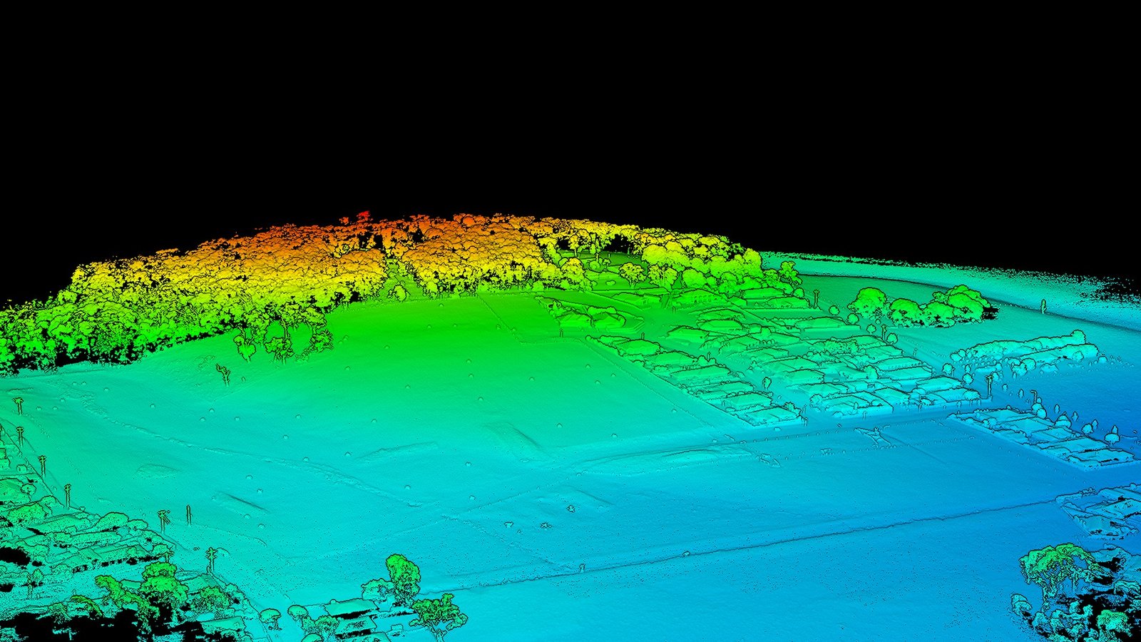
Creating a DEM from drone imagery involves several steps. A drone equipped with high-resolution cameras captures overlapping aerial photographs of the project site. Specialist software then analyses these images to identify common features across multiple frames, calculating the three-dimensional position of thousands of points.
This process, called photogrammetry, creates a point cloud containing millions of elevation measurements. These points are then interpolated to create a continuous grid—the DEM. Ground control points (measured using GNSS/GPS) are incorporated to ensure the DEM is accurately positioned and scaled.
The result is a highly accurate, georeferenced elevation model that integrates seamlessly with GIS systems, CAD software, and earthworks planning tools.
Common Earthworks Use Cases
Land Grading and Site Preparation
Before development, sites often require significant grading to achieve design elevations. DEMs guide these operations by showing current vs. design elevations, enabling contractors to work efficiently and avoid over-excavation.
Road and Pavement Construction
Road design relies on precise knowledge of existing terrain. DEMs provide the base elevation data for horizontal and vertical alignment design, ensuring optimal road geometry and drainage.
Dam and Pond Construction
Dam volume calculations, spillway design, and inundation mapping all depend on accurate elevation data. DEM-derived bathymetry can even be extended underwater using additional surveying techniques.
Mining and Extraction
Mining operations require regular volumetric surveys to track ore extraction and tailings management. Repeat DEM surveys provide objective measurements of mining progress and material quantities.
Infrastructure Projects
Pipeline routes, utility corridors, and underground services benefit from DEM analysis showing slope stability, drainage patterns, and environmental constraints.
Accuracy and What to Expect from Drone-Derived Elevation Data
The vertical accuracy of drone-derived DEMs depends on several factors: flight altitude, camera resolution, ground control point density, and terrain characteristics. Typical accuracy ranges from 2cm to 15cm RMSE (Root Mean Square Error) at flight altitudes of 50-150 metres.
For earthworks projects, this level of accuracy is more than adequate for cut and fill calculations, volume measurement, and grading verification. In fact, the consistency and spatial coverage of drone-derived DEMs often exceeds what's achievable through traditional surveying at equivalent cost.
We always provide accuracy estimates based on your specific project requirements, ensuring the DEM meets your engineering standards.
Why Choose Aerial Imaging Australia
Across South East Melbourne and beyond, construction and earthworks teams rely on our expertise in drone-derived DEMs. We understand the specific requirements of earthworks projects—from initial feasibility studies through final grades verification.
Our team delivers DEMs that integrate with your existing workflows, whether that's CAD design software, GIS analysis, or construction management systems. We provide comprehensive documentation including accuracy assessments and metadata, ensuring your data is defensible and audit-ready.
Every project receives dedicated support from experienced operators and analysts who understand both the technical requirements and the practical challenges of earthworks delivery.